|
|
|
|
Kilauea Volcano on the island of Hawaii is extremely active right now. The toxic gasses being released have increased each month since the begining of the 2008 and resulted in parts of the island being declared a disaster area in 2009 to support Hawaii Island farmers and flower growers that lost their crops. Some towns are becoming uninhabitable and the county has notified island residents that they should not wait for an alert if they feel ill from the volcanic output.
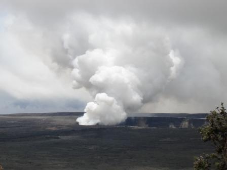
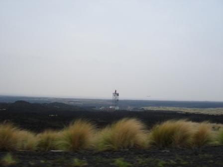
KILAUEA ERUPTIONS ON THE BIG ISLAND OF HAWAII Kilauea is on the southeast side of Mauna Loa on the Island of Hawaii and has an elevation of 4,091 feet (1,247 meters). The caldera of Kilauea is within Volcanoes National Park and there are many lookout points from which you can peer into the massive caldera. Within the caldera is a smalerl crater called Halema'uma'u that is currently spewing out an incredible amount of gas, ash and occasional eruptions of lava. From Volcano House, a hotel inside the Volcanoes National park and and across from the park's Visitor's Center, this is the view of Kilauea caldera and the emissions from the Halema'uma vent.
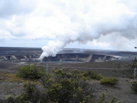
A lookout at the Jaggar Museum allows a closer view of the Halema'uma crater.
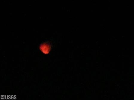
The USGS has a live CAM of the eruption activity. At night the crater sometimes glows and even emits bright red particles high into the sky.
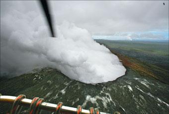
Another vent (Pu'u O'o vent) about 15 miles from the Kilauea
caldera towards Hilo, is also very active, spewing gasses in earnest and has creating a cinder cone.
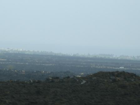
It has been active a while, but the amount of emissions is increasing adding even more gas and vog (volcano fog) to the area. Pu'u O'o vent covered many historic temples, beaches, and houses in the late 1980's and the town of Kalapana in 1990. Now the flow is going in the opposite direction burning through a forest. IMPACT OF THE VOLCANO TO HAWAII There have been 45 major eruptions of Kīlauea in the 20th century. A recent lava flow in 1990 caused a great deal of destruction in Puna and completely destroyed the towns of Kalapana and Kaimu. Kilauea has been known to have explosive eruptions, one in 1924 when the lava lake in Halema'uma'u crater reached ground water. A larger eruption occurred in 1790 when the eruption column was as high as 10 miles. Recent volcanic events have included 3 lava flows into the ocean off the Puna coast near Kalapana as well as increasing activity of the Halema'uma'u and Pu'u O'o vents. On March 19, 2008, Halema'uma'u had an explosive event generating a magnitude 3.7 earthquake, and scattering rocks over a 75-acre area. The debris covered part of Crater Rim Drive and an overlook. On March 24, the white gas turned brown-gray and lava particles were emitted. Earthquake activity has been on the rise along with rising amounts of dangerous Sulfur Dioxide (SO2). A thick continuous cloud of white smoke and toxic gas often inundates the little town of Pahala nearby Volcano and parts of Ka'u impacting the residents of Oceanview and Na'alehu, their crops and their health. The sunny Kona coast has been dealing with gray skies whenever the trade winds blow and Maui and Oahu are also troubled by vog. The difference from previous explosions is the high level of SO2 being emitted which is creating acid rain and potentially dangerous air conditions. At this point there seems no end to the continuous eruptions from the volcano. Information about the toxicity of SO2 is available here from the ATSDR (Agency for Toxic Substances & Disease Registry). Information about Hawaii's Current Air Quality Conditions from the EPA are here. Here is a view from Hwy 11 driving past the Kona airport.
Here is a video of the drive by the Kona airport. Normally you can see a crystal blue ocean beyond the black lava.
This is a picture of the vog over Waikoloa. This vog crosses over the short distance to Maui and on many days is blown to Oahu.
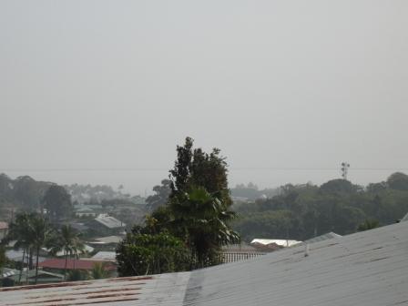
THE IMPACT OF THE VOLCANO TO HILO Hilo is the farthest east point in the Hawaiian islands and as a result it seems to be least impacted by the vog. When the trade winds stop, it gets a thick haze from buildup of the emissions pooled up in the area. As soon as the wind starts up, the haze moves out. Below is a voggy morning on May 15, 2008, during a time of no trade winds.
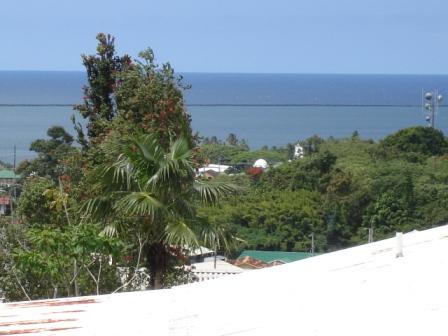
Later the same day, winds moved the vog out of Hilo and the view looked like this:
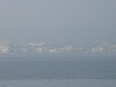
Here is a view of Hilo from across the bay on a voggy morning. This level of vog is very rare in Hilo compared to the more continuous vog on the West side of the island.
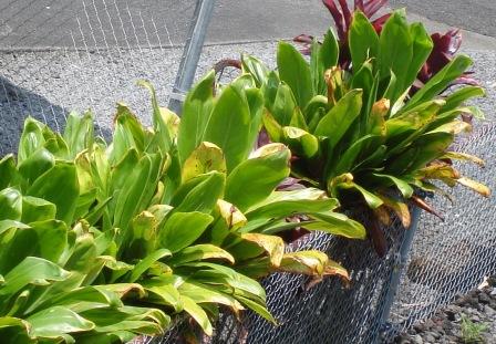
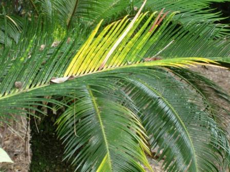
People have different reactions to the vog. Some get sore throats and feel terrible and others barely notice. It is the same with the trees and plants. Some plants dry out and die while others seem to love the acidity.
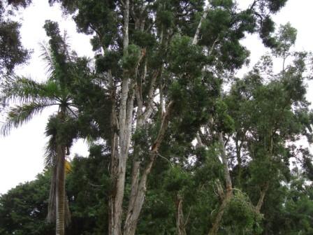
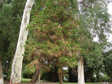
These Eucalyptus trees in Hilo look like they are dying. Huge branches are falling to the ground.
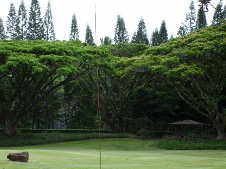
These trees below are unaffected.
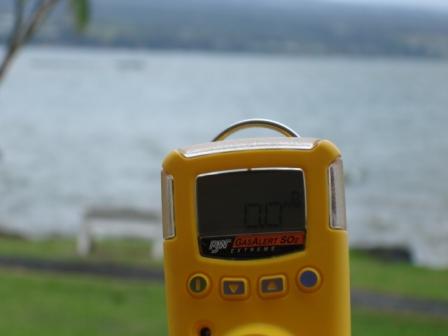
WHAT WE ARE DOING TO PROTECT OURSELVES AND PREPARE Real time information about the air quality due to the volcano is limited. Our best source of information on the volcanic gas output is the live CAMs in Volcanoes National park in the Kilauea crater. We know that Sulfur Dioxide (SO2) could be a significant health problem and so we prepared ourselves by buying a detector that warns us when the SO2 levels get dangerous. We bought our "BW Gas Alert - Single Gas Detector - Sulfur Dioxide" online from Grainger. Hydrogen Sulfide (H2S) is an even more deadly gas from volcanoes, but it smells strongly of rotten eggs, so if you ever smell that, get out fast!
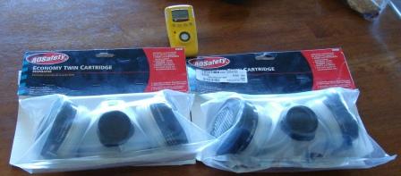
Having an early alert system doesn't make sense without a plan for taking action once it goes off. We bought gas masks from Ace hardware store to use in case our SO2 detector starts beeping due to high levels of SO2. The masks have carbon activated filters that protect against toxic gas. Their purpose is to give us time to get out of the area. They won't protect for long periods. Our distributor tells us that SO2 reduces oxygen to the body, so you can't go to sleep, even with a mask on or you will suffocate at the levels of SO2 being reported near the volcano ( 9 parts per million).
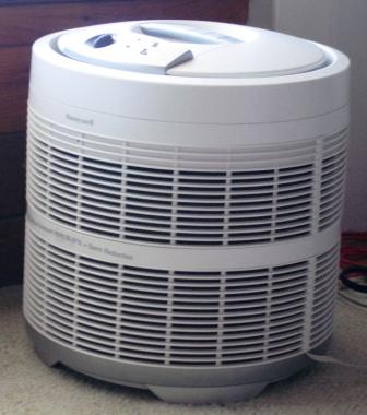
You can order better masks from professional equipment that can be used for extended use in high SO2 and are battery operated. If the SO2 is just in the unhealthy range, we have carbon based Hepa air filters. We brought Honeywell Hepa Air filters from the mainland.
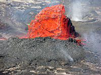
We have been taking SO2 readings in Hilo and on the worst day the readings have been up to .5PPM (25% of the Federal maximum level). The vog has been heavy several times, but it hasn't always resulted in a SO2 reading. A large eruption will likely be accompanied by a large earthquake. So we have prepared for earthquake by having tents, sleeping bags, storing water and all the other basics for earthquake survival. OTHER SOURCES ON THE VOLCANO Here is a blog entry about vog in Wood Valley near Pahala on the Big Island and the difficulty it is for this resident. Richard Ha blog entry has some dramatic photos of Kilauea lava flowing into the ocean. A fountain of lava spewed over 40 feet high in a Kilauea breakout about 2 miles east of the Pu'u'o'o vent and 6 miles from the ocean on July 7, 2008. Since the breakout, sulfur dioxide emissions have doubled mostly impacting the Ka'u district and Kona.
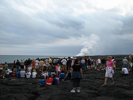
Here is USGS film of the lava fountain on July 6. It takes a while for the movie to load, but it is worth the wait. Five breaks in the lava tubes connected to the Pu`u `O`o vent have occurred, likely due to increased lava flow that overflowed the tubes. The video shows other lava breakouts, all potentially new vents on Kilauea that may emit toxic gasses and lava in concert with the Pu'u'o'o vent and Halema'umanu vents already going off. A close-up of the fountaining lava starts in the middle of the video. Seeing it is another reminder to me that our nearby volcano is very alive and powerful. You can see the Halema`uma`u vent in Kilauea caldera from several locations in Volcanoes National Park. You can view the lava flow into the ocean with the crowds by driving through Puna to the end of the road in Kalapana where a Hawaii County lava viewing area has been set up. The Pu`u `O`o vent is off limits to visitors.
This is a video of the volcanic activity from the Volcano House viewing area:
This is a video of the volcanic activity from the Jaggar museum lookout.
Copyright 2008 - 2017 |